Thursday, December 8, 2011

Monitoring at Bellvue and Wrap-up

By Kim Pause Tucker, Ph.D.

Our last day in the field was to be spent monitoring a restored shoreline at a second site (Bellvue boat ramp).  Although I had planned for the tides to be low, the high winds caused the tide to be higher than expected. 

Nonetheless, Jan Mackinnon, our collaborator with GA DNR (also an adjunct professor here at CCGA) had us monitor the Spartina and whatever oysters that were uncovered.  Her guidance this semester has been integral to the success of this course, and we are so appreciative.  We hope that our efforts in bagging, monitoring, and removing invasive species have helped the DNR in their mission.

If you are a CCGA student interested in Coastal Ecology or Conservation Biology, feel free to contact me ktucker@ccga.edu.  Other faculty members that teach in the Ecology track are Drs. Rebecca Yeomans, David Stasek, and Hazel Delcourt.  We would all be happy to speak with you about our program!


Tuesday, December 6, 2011

Altamaha Waterfowl Management Area

 Invasive Species Removal
By Richard DeLorenzo


           On Friday, November 11th, Dr. Tucker’s Conservation Biology class visited the Altamaha Waterfowl Management Area. The management area consists of 3,154 acres of managed waterfowl impoundments and some 27,000 acres of bottomland hardwoods and cypress-tupelo swamps (http://www.georgiawildlife.com/node/1406). Waterfowl depend on wetlands for their survival, however wetlands are rapidly declining. In order to preserve these animals’ natural habitats, state and federal agencies are working together to create management areas. Managed waterfowl impoundments provide the best habitat for migrating and wintering waterfowl. The key to a successful waterfowl impoundment is the ability to control the water level. A dependable water supply is a must. If you can control the water, then you can influence the vegetation in the impoundment. By manipulating factors such as water depth, timing of flooding, duration of flooding, and timing of drawdown, you can provide the proper conditions for growing a variety of food plants that are highly preferred by ducks (DNR).

Although these conservation efforts are in place, the up keep of the impoundments must be maintained. Our class was going to be providing assistance to local DNR biologists in their maintenance efforts of the native vegetation. Eamonn Leonard was the botanist that would be leading the expedition for the day. He was extremely knowledgeable in his field and gave a background on how he ended up at DNR. The major goal for the trip was to remove some Invasive plant species from the management area. A species is categorized invasive if it is not native to the location where it is currently found, and harms or discourages other species from persisting. Chinaberry and Chinese Tallow are two species of plants that are considered invasive to South Georgia, and are in abundance at this particular management area. The Chinaberry has no natural insects or diseases to keep them in check. Both species are crowding out native species, taking valuable resources from the environment, decreasing the amount of available resources for native species. Both of these species are large growing and can take up a large amount of resources.


In order to remove these species from the area the class used machetes and hatchets to chop them down. Once the trees were chopped down and/or wounded, a combination of roundup and diesel fuel was used as a pesticide to destroy the plant. Adding diesel to the Roundup allows for much better absorption into the tree. It also coats the leaves causing photosynthesis to be far less efficient.

I am not an avid hunter, and have never been duck hunting. Seeing the abundance of different species of fowl in the area was eye-opening. Duck hunting plays an important role in the community, and maintaining these management areas allow the animals to be hunted at a sustainable rate. Although I have lived in this community my entire life, this was my first visit to the Altamaha Waterfowl Management Area. I did not realize that there was such a problem with the wetlands declining, nor the importance these wetlands played on different species. Learning about particular topics, like invasive species, and then being able to apply that newly gained knowledge is very important. I did not realize that many local areas are being affected by the very topics we are discussing in class. It was neat to see what local DNR are working on, and get biologists’ perspectives on the community. Getting the chance to help out the DNR and gain knowledge was a great experience and was actually pretty fun.

Once these plants are removed, the native plants will have a better opportunity to flourish, providing a more natural sustainable habitat for the waterfowl population. Invasive species are major problem in many areas and it takes a lot of effort to get rid of these pests. It took approximately two hours in order to remove about 100 yards of these invasive species. This is only a small dent in the amount of vegetation that needs to be removed. It is up to the community to step in and help protect their local flora.


Invasive Species Removal
By Gwen Lowe

Conservation Biology is about using science to preserve different species and ecosystems around the world. In class, we discussed topics such as overexploitation, invasive species, economic values for ecosystem services, and problems that threaten biodiversity.  In discussing these problems, Conservation Biology gives ideas of what individuals can do to help eliminate problems that the ecosystem faces.
On November 8, 2011, the conservation biology class worked side by side with Georgia Department of Natural Resources. Will Ricks was one of the facilitators who explained the process of the day.  He is a Wildlife Biologist who mainly focused on the Waterfowl area in Brunswick.  The Altamaha Waterfowl Conservation Area consists of over 3000 acres of managed waterfowl impoundments.
We observed some native plants in the area, including the Button Bush.  Animals such as the mallard ducks and teal ducks consume the Button Bush. The process for the day was to eliminate and destroy invasive plant species. Eamonn Leonard, a botanist with GA DNR, explained that the invading species that we were trying to kill consisted of the China berry and the Chinese tallow. These plants were brought in years ago thru Savannah. Now they have become abundant and are out-competing the native species. Roundup and diesel fuel were mixed together forming a solution to help kill these invasive plants. In this process, we had part of the team to cut the limbs of the trees and the other half of the class came behind them and sprayed the parts of the tree that were cut with the solution.  The class and the DNR were pretty much successful in getting the job done over a small area. We probably could have covered more ground if time had allowed us to do so.
This process goes along with the lecture of invasive species. We were taught that invasive species can outcompete the native species for resources.  Invasive species pose threats to native animals and other plants.  The individuals from conservation biology who participated in this procedure all brought a positive attitude.  We were all eager to learn about how to destroy invasive plant species!  This experience proved to me that there is much work involved with the process of killing invasive species.  Once an invasive species is established in an environment, it can be nearly impossible to remove it completely.
The group worked well together as a team. Teamwork is a very important factor in processes such as this one, and my favorite aspect of this type of work.  We all worked together and accomplished the task for the day.  Also, I’m a people person with great communication skills which played a large role in getting information needed to write this blog.  Communication was necessary!  Anywho, I’m glad that I could donate my time for a worthy cause.  This was a meaningful project that taught me more about handling invasive species.  Although we had already talked about it in class, I actually learned more about the process by doing hands-on work with it. Even though the class and I smelled of diesel fuel, this was my favorite project for this semester in conservation biology.

Friday, November 25, 2011

Monitoring a Restored Site: Jekyll Island


Monitoring a Restored Site: Jekyll Island
By Brandon Thornton

          For the service project on this field day we applied the protocol for oyster monitoring that we learned on Sapelo Island. We learned this from Daniel, a researcher for the Tybee Island Marine Science Center. We were trying to monitor the success of the population of oysters on Jekyll Island. In this, we had to measure the distance from the vegetation area to the shore. We had to pick three areas to count oysters alive and dead in square meter quadrats. One set of oysters would be close to the vegetation, one near the water, and then one in the middle. We also had to measure 30 oysters out of the samples with calipers. We also made notes of any other mussels, crustaceans, mollusks, or vegetation in the plots. After monitoring the oyster area, we had to monitor the vegetation in front of them.
We mostly had Spartina in this particular area, but we also looked for Distichlis and sea ox-eye daisy (Borrichia). For this part of the monitoring, we had to pick three areas going backwards from the oyster beds. In them we measured the amount of live Spartina, and the tallest five Spartina plants height in centimeters.
Therefore, the monitoring was actually a simple process, but conditions of the day made it slightly more difficult. One thing about doing this field work is that one does not know how the weather will be each week. I think it was chilly only on the days we did monitoring, and this day of monitoring was a windy day, also. Another factor unexpected was the messiness of the area. There was a ton of mud where these oysters lived because they are underwater during the high tides. We learned to be prepared for field biology work. Many of the people with these careers deal with tougher conditions than what the class sampled. It could be bad weather, muddy, long or early hours. Despite the conditions, it is something that people still enjoy by being a part of an effort to conserve the wildlife of the area. It is really something a student in biology or a professional can work together and both get something out of it.
As far as the curriculum learned for the past week, we just finished our second exam over Threats to Biodiversity and Conservation at the Population and Species level. Then, we began a new chapter with a discussion Protected Areas. I am not sure if this oyster monitoring sight is a governmentally protected area, but I do not expect anyone to be walking through there anyway. This was more an application to population conservation by monitoring the number of oysters and plants that grow with them. It seemed to be a healthy area for the oysters to continue growing. So with them increasing their population, hopefully this will balance out the threats and help add to the biodiversity by attracting young fish and other marine invertebrates. 
 This activity for the day did enhance my understanding of practicing conservation. It showed me more on how fun and dirty field biology can be. It also showed me how valuable it is to work together with a team even on an easy task like ours.

Tuesday, November 15, 2011

Manatee Health Assessment - Crystal River, FL


Manatee Captures for Health Assessment 
By Michael Mock
 

             On November 9th and 10th 2011, Dr. Tucker selected five students from the conservation biology class to participate in manatee captures for health assessment in Crystal River, Florida.  Students from the College of Coastal Georgia, as well as, veterinary students attending the University of Florida and other Universities and agencies worked alongside scientists from the United States Geological Survey and the Florida Fish and Wildlife Conservation Commission.
            The Florida manatee is a large aquatic mammal that migrates to the warmer waters of Florida in the winter months of the year to thermoregulate.  Manatees live in a wide variety of environments and can be found in areas as diverse as large urban waterways to freshwater artesian spring habitats with little human interaction and even salt marsh habitats.  Manatees face a number of factors that make them vulnerable to population decline, making their well-being of particular interest to conservation groups.  One of these factors is the manatee’s low reproductive rate, only having one calf every three years and having an 11-13 month gestation period.  Along with the reproductive rate, the calf is usually dependent on the mother for two years which requires significant parental investment.  Florida manatees are also thought to have low genetic diversity which could be the result of the founder effect, suggesting the population was started by only a few individuals or was dropped to a low number at some point in the past.
            The purpose of the captures was to gain knowledge of the health, sex ratio, genetic diversity, and migratory patterns (through telemetry) of the manatees that were present in this area of Crystal River.  With regular assessments, the data that is gathered can be used to show patterns and assess the health of the manatees in the area.  It can be treated as a baseline for future studies as well.  Is the population declining?  Staying the same?  Or is it improving?
            Manatees were initially spotted by a team using a bridge as a good vantage point.  Once spotted, a team on an adjacent beach was alerted and prepared to encircle the passing manatee with a large net being trailed from the capture boat.  Once confined in the net, a team standing on the beach pulled the net in and landed the manatee on the shore.  Lone manatees were targeted as to not separate a cow and calf pair in most cases, yet some pairs with older calves were captured.  Once on the shore, the manatee was moved in a stretcher apparatus carried by 10-12 individuals to a transport boat to taxi the animal around the bend to the data collection beach.  This small beach was outfitted with several tents which held different stations to gather various kinds of data.  Being removed from an aquatic habitat and surrounded by strange people in the terrestrial environment caused the manatees to struggle in some cases, but for the most part were calm and kept as comfortable as possible.  Blood was drawn, all vitals were checked first thing and small tissue samples were taken for genetic and contaminant analyses.  The animals were also weighed and morphometric data was collected by measuring the length and girth of the animal at several points.  The sex was also recorded. The manatees were scanned to see if it had any pit tags indicating it as being an individual that had already been previously captured.  These pit tags are similar to the microchips that they put in your household pets nowadays.  If no pit tag was found, one was implanted in each shoulder area and recorded in a log so the individual could be documented.  One of the more interesting aspects of the captures was the photo identification of each manatee to include in the database of manatees using external features such as scars from boat strikes or any other distinguishing features.  These photos are compiled to have a list of members of a population so identification can be done to recognize manatees if observed or captured at a later point.  The manatees were kept on land for an average of an hour with regular application of water to the body and oxygen supplied to ensure their comfort and their health status.
            This experience allowed me to get an idea of the kind of work and man hours required for the conservation efforts that go into the preservation of one species.  The amount of data recorded in just two days will take a great deal of time to evaluate and used to make management efforts more efficient.  The attention paid to detail, as well as the requirement of consistency were paramount while working with animals that are so important and fragile in an area.  The care for the animal was also of high importance, making sure that conservation efforts do not cause more harm than good.  Respect for the animal while gathering data was balanced well, so I believe that this particular event was successful and will go far in the protection and promotion of this important species.

Tuesday, November 1, 2011

Sapelo Island - DD

Learning the Living Shoreline Monitoring Protocol
 By David DeSalvo

(Photos courtesy of Betsy Kane, CCGA) 

On October 28th, 2011 our conservation class went to Sapelo Island to learn the protocol for monitoring a restored Living Shoreline project site. This is an ongoing endeavor in Georgia headed up by the Georgia Department of Natural Resources, the Nature Conservancy, and other academic and government partners.
The goal of this on-going project is two-fold: “To study the feasibility of alternative techniques to traditional shoreline hardening in tidal wetlands (i.e. alternatives to riprap and bulkheads), and to determine the effectiveness of alternative erosion control methods that will protect and enhance ecosystem function.“ http://coastalmanagement.noaa.gov/mystate/docs/ga3092011.pdf Creating a Living Shoreline, as opposed to a rigid concrete structure, which will provide a natural remedy for erosion occurring on intertidal banks as well as provide a much needed habitat for various marine life. The added vegetation will also stabilize the soil and complete the natural barrier. Additionally, the restored oyster reefs will improve the environment by providing habitat for fishes and be filtering water.
The Living Shoreline sites were restored via two primary methods. One way is through the use of mesh bags filled with oyster shells and arranged at one site in two layers along 370 feet along the creek bank. At another site they have placed Gabions, which are 6 feet by 12 feet, and house compartments made of chain linked steel then filled with a combination of bags of oyster shells, loose shells, and rock. This structure is used on steeper banks and the individual compartments prevent the shifting of the bags due to the sharp incline. The idea behind these are the same, the oyster shell provides a substrate for the oyster larvae or spat to adhere. After some experimentation, it was found that the calcium carbonate found on the inside of oyster shells provides the optimal surface for attachment. As oyster larvae attach, grow, and eventually die, this process repeats. This renews the oyster population, provides habitat for marine life, and prevents erosion as sediment builds up.
Our class helped monitor this process by using a method to assess vegetation and oyster recruitment along two of the banks. At several designated sites we laid three transects. By measuring from the top of the bank to the water line, we established a top, bottom, and middle location for our transects. In those transects we counted the number of both live and dead oysters, as well as, took note of the other species that may have been present. We then measured the length of 30 oysters to find an average size. For the vegetation, we found a mid-point and measured the percentage of different species such as Spartina, Distichlis, and Sea Oxeye Daisy. This protocol is done regularly at nine designated places at this site to monitor the progress being made. This project seems to be successful as recruitment has increased and the banks appear to be stabilizing.
This experience linked with class work as we were learning about the value, both direct and indirect, of environmental resources such as intertidal marshland. Marshes have a unique ability to assimilate nitrogen and other pollutants as well as offer flood protection. They also serve as a large source for food and industry. The seafood industry off coastal Georgia alone stands at an estimated 44 million dollars. However, the value of these environments is not just direct, the indirect benefits can be spiritual, recreational, or just the fact that a healthy environment seems to affect our individual health in a positive way.
Our class had learned about the Living Shoreline project before bagging shell at the GA DNR Coastal Resources Division; however, this trip seemed to tie the whole picture together. Everything from some of the planning done by the DNR, the bagging of the oyster shells, and the creation of a living shoreline, and finally the monitoring activities provides a clear picture of how a project like this is accomplished.
It was a beautiful day and the overall experience was entirely positive. I have found experiences like this help connect what we learn in the classroom to the practical real world application of what some of us may do in the field as biologists. It may also help to instill an appreciation for the environment as well as an understanding of its fragility.


Sapelo Island - EHB


Adventures on Sapelo Island: Learning the Monitoring Protocol
By Ethan Hunter Barnhill

     Our conservation class took a trip to Sapelo Island on October 28, 2011. We took a van from CCGA at 7:15 to catch the ferry that goes over to Sapelo Island only a few times a day. Sapelo Island hosts a large number of government and academic partners that are working on multiple marine and shoreline projects. Scientists on Sapelo are involved in many projects including habitat restoration, oyster reef ecological studies, and invasive species monitoring. Our purpose on this trip was to investigate one of these projects called The Living Shoreline Project. Federal, state and academic partners are working together to provide research about the living shoreline and how beneficial it is. Researchers’ goal for the living shoreline is to provide an environmentally friendly alternative to putting up hardened materials that have traditionally been used to prevent erosion. The goal of our trip was to view and help monitor the two areas that have been restored with living shorelines on Sapelo Island.

     When we first arrived, we had to ride in a van from the ferry dock to the conservatory where they are doing the testing. Most vehicles on the island have been there for a long time and our van was no exception. The age of our van made the trip a bit more exciting! The side door had no handle and the back door wouldn't shut. On the way the guides from the DNR told us about some of the native species and about the people who still live on the island. Nonetheless, we made it there alive and safe.

     The first site that we viewed was the Long Tabby site. The oyster bed at this site was made of gabion baskets which consisted of chain-linked welded steel measuring 6 feet by 12 feet.  These baskets were filled with a combination of bags of shell, loose shell and rock that stretch along a 230 foot area. Gabions were chosen because of the steep slope. Daniel said that they were first very skeptical about the use of gabions due to the concern about how the oyster shells started falling in the baskets causing it to have a ripple look. However the ripples have proven to be beneficial because sediment from the water has collected and only those that protrude out have really seen much growth. In addition, native species of plants have been added along the shoreline to promote a healthier and beneficial environment.

     The Ashantilly site consisted of mesh bags of used oyster shells arranged in two layers along a 370-foot section of the creek bank. This area was far less steep, so it was easy to climb down to measure and get accurate readings for observation. We used a protocol we dubbed "Daniel's protocol". The first part of his protocol was to measure the oyster bed from top to bottom and place a quadrat at the top, middle, and bottom of the bed. Within each of those quadrats, we measured the number of live and dead oysters, the presence of predators and other animals, and the lengths of 30 oysters. We recorded all of the data. The next part of “Daniel's protocol” was to measure the vegetation that was planted behind the restored oyster bed. We did basically the same method as the oysters, except we measured from the oyster bed to the edge of the natural growth. Using the same concept we took three quadrats and placed them at the top, middle, and bottom. From those we counted the amount of Spartina and other native species in each. Then we measured the ten tallest Spartina and recorded their heights. Daniel pointed out that one of the major objectives was to try to get the Spartina to grow through the oyster bed and sprout back up. This would help in building a much stronger shoreline, preventing further erosion.  
     We decided after we completed testing that we would ride over to the beach. The beaches there felt deserted compared to those on Saint Simons Island. We had so much space to ourselves in which to have fun looking for sea shells and sand dollars. It was the perfect ending to a good trip. I believe we must have been having too much of a good time because we had lost track of time and had to rush back to the van and drive to make it to the ferry.  They were about to pull away with the gates closed when we arrived to the docks. Thankfully they allowed us on!
     I learned a great deal from this experience about the conservation of this special and unique environment.  It is important to help conserve Sapelo and other natural habitats for future generations. 

Tuesday, September 27, 2011

Clam Creek Marsh Monitoring 9/23


Clam Creek Marsh Monitoring-We Return
Will Davis

Clam Creek is a scenic spot for horseback riding, fishing, shell collecting, and just enjoying a day.  It is located on Jekyll Island, one of the eight barrier islands off the Georgia coast.  Jekyll is one of the four barrier islands accessible by car.  In addition to the fun activities, mentioned above, Clam Creek is home to Georgia’s second state bird, the mosquito.  Due to improper drainage and a restricted tidal flow when a non-vehicular bridge was constructed, mosquito larvae flourished in standing water from rain that was of a lower salt content than the water naturally found in the area.  In addition to the abundance of mosquitoes, the normal flora, including Spartina, Juncus, and Distichlis were displaced by less salt tolerant plants.
To solve this issue, the culvert pipes that were restricting flow both in and out of the area were removed and a bridge with a larger non-restrictive opening was constructed.  The types and health of the three marsh plant species needed to be monitored to keep an eye on how the project was progressing.  That is where we came in…. again.

Our fearless crew took the most remote areas to monitor, fighting through mud, water, and marsh plants only to find more mud, water, and marsh plants.  Then we measured plant growth in pre-determined meter square segments.  Spartina, Juncus, and Distichlis were checked for numbers, percentage of ground covered by each, and also the height of the largest Spartina was measured.   The fauna that were found on previous surveys were absent on these segments so we saw no crabs, mussels, or snails.  These segments were also the furthest from the tidal flow.

The salt hardy plants appear to be making a comeback in these areas.  The higher salinity brought about by the better circulation has helped these plants to get a foothold, and with the non salt tolerant plants being removed by the salt, the marsh is regaining lost ground.   The standing water being drained and replaced by a water of higher salinity not only brings the marsh plants back but also reduced the breeding ground for mosquitoes.  Even though some mosquitoes will breed in salt marshes, mosquitoes need still water for the larvae to reach adulthood.  Even the tidal flow of water can disrupt the life cycle.

The results from lessening the restriction on the waters would seem to be less mosquitoes and a more gradual or soft edge for the Spartina growth.  With the path no longer as an edge, the grasses are not met with a severe change between one side of the path to the other.  Further monitoring is required to see if this is the final answer, but after several visits it seems to be working.

Tuesday, September 13, 2011

Clam Creek Marsh Monitoring - 9/9


Clam Creek – Marsh Monitoring 9/9/2011 By Kari Tracy

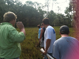
On September 9, 2011 our conservation class took a trip to the Clam Creek marsh on Jekyll Island to assist in monitoring an on-going project sponsored by the Georgia DNR (Department of Natural Resources) and the Glynn County Engineers.
So you may be wondering, what is the big deal? Why should we spend our money and time to protect these marshes? Besides the natural enjoyment humans receive from the beauty of the marshes, referred to as biophilia, these coastal marshes provide its local residents with many direct and indirect values. For instance, did you know that 70 percent of the recreationally and commercially important fishes, crustaceans, and shellfish spend part of their lives in the estuary that these marshes inhabit? Also, the marshes create a place for ecotourism. This means money coming into the surrounding communities. Although direct values (the money that comes from them) such as these are nice, sometimes it is the indirect values that we benefit most from. Just a few of the indirect values that the salt-marshes offer are: mosquito control, inland protection from weather forces (such as hurricanes), and even water and air quality control (marshes naturally assimilate nitrogen and pollutants).
The area that our class is working on with Georgia DNR and the Glynn County Engineers is on Jekyll Island where a bike path was constructed through the marsh. As a result, the bike path cuts off the marsh and creates a pocket marsh. In order to allow water to flow from one side of the marsh to the other, large pipes were laid in the bike path foundation. Unfortunately, these pipes have proven to be inefficient for several reasons. The first reason being, they are placed too high and the water is not able to flow through easily. Another reason it did not restore the hydrology is because even when the water level is high enough to flow through, the opening of the pipe is not large enough for the amount of water needed to fill the pocket marsh. This interruption of water flow into the pocket marsh caused a major die-back in many of the natural marsh plant species such as: Black Needle Rush (Juncus roemerianus), Saltgrass (Distichlis spicata), and Salt Marsh Cordgrass or Smooth Cordgrass (Spartina alterniflora). Less salt-tolerant species were able to become more prevalent in the area. Additionally, the water in the area was no longer moving due to tidal influence, causing an increase in the mosquito populations growing in the area.
In an attempt to restore the water flow from the marsh to the pocket marsh created by the construction of the bike path, the Glynn County Engineers removed the inefficient pipe and replaced it with an open bridge in hopes of restoring the dying marsh. The open bridge would allow the water to flow freely to the other side and the salt marsh plants and fauna would expectantly be restored. To track the progress of the marsh restoration, it is necessary to designate certain points or areas to consistently monitor. This is what our class partook in: monitoring of the progress after the installation of the bridge.
On September 9th, 2011 our Conservation Biology class completed transects for the pre-designated points in the marsh. We counted the number of live Juncus and Distichlis stems, and also the number of live and dead Spartina stems. Then we recorded the percent cover of each species (including browning and dead species of other plants other than Spartina). Next, we measured and listed the height of the five tallest Spartina plants and noted the color of the plants in the plot. After all the plant species counts were completed, we counted the number of live and dead periwinkle snails and mussels. We estimated crab abundance by counting the number of crab holes larger than five millimeters (about the size of a pencil eraser). We also tried to acquire an accurate reading of the salinity of the water per each sampling point. The salinity was taken using a refractometer. A few drops of water collected from a freshly made hole was placed in the refractometer and the salinity then observed. We found that in many places, water did not fill the holes we created. This means that the area did not have recent water flow. The water that was tested from a few of the areas implied that the water had a very high salinity. It was suggested that the drought could be causing a higher than normal salinity. This could affect the vitality of the plant species and also the fauna in the marsh. Many of the pine trees were already losing their pine needles—which could be a possible result of the increased salinity.
Overall I enjoyed myself and so did most of everyone else. The weather was nice for being outside and there were almost no bugs (an uncommon event in the South). It was a great learning experience and we made great connections!

Clam Creek Wetland MonitoringBy Shawn Flanagan
Jekyll Island is a barrier island located in southeast Georgia. In the 1880’s, Jekyll Island was home of the Jekyll Island Club, which was a getaway for many aristocratic families such as the Rockefellers, Vanderbilts, Morgans, and Pulitzers. They came to get away from the hustle and bustle of the city and enjoy the peace and tranquility that Jekyll Island offers. Thousands of people still travel here every year in order to enjoy its rich history along with its natural beauty. Jekyll Island is home to an extremely complex and delicate tidal marsh ecosystem. The marsh ecosystem is home to several unique species of fauna and vegetation. Our service-learning project for the semester was to monitor a wetland site in the Clam Creek picnic area, on Jekyll Island.
The site that we surveyed was along the clam creek bike path. Initially, when the bike path was built, a 6 inch in diameter drainage pipe was put into a concrete walkway to allow tidal flow to reach behind the path. Unfortunately the volume of tidal flow was unknown and the 6 inch pipe was too small to allow adequate passage of water. Inadequate water flow to the marshland behind the path caused a change in the pH and salinity within this section of the marsh. This change created a freshwater mosquito breeding ground and altered the flora and fauna in this section of the marsh. A large amount of dieback was observed after the installation of the path. In an attempt to restore this section of marsh, Georgia DNR, along with engineers from the Glynn County Engineering Department, removed the section of path with the drainage pipe and installed a foot bridge. This bridge allows much more tidal flow to enter the marsh, which in theory would restore the area to its previous pH and salinity, eliminating the large amount of mosquitos restoring the flora and fauna. DNR tasked us to record data from this site as a service-learning project.
The area along the clam creek bike path was broken into five transects with varying quadrants in each transect. We used a tool (four pieces of half inch PVC pipe strung together in a square) that measured an area 1 m² and oriented it north in order to create the quadrant itself. We used the same protocol that was previously used by various groups for the marsh-dieback analysis. We recorded specific flora and fauna within the quadrant. The flora that we were specifically looking for in each quadrant were; Spartina, Distichlis, and Juncus. We recorded the approximate percent that each species covered within the quadrant. We paid very close attention the Spartina, because it is a keystone species within the marsh ecosystem. The fauna that we were looking for in each quadrant were; periwinkle snails, holes indicating the presence of fiddler and mud crabs, and mussels. Any other fauna was also recorded. After the vegetation and fauna was recorded, we used a PVC pipe to create a small hole next to the quadrant for water to collect. A small sample of this water was collected and placed on the lens of a refractometer in order to determine the salinity and specific gravity. Finally, we took a photograph of the quadrant so that it could be saved for reference. We repeated these steps for each individual quadrant.

View Clam Creek Site in a larger map
The first time that we surveyed this location, we learned about the protocol and recorded data for three locations on the southwest side of the bridge. This service-learning project is not only important, but also very applicable to what we are learning about conservation ecology. This particular part of Jekyll Island is enjoyed by many people for its scenic view and the opportunity it gives people to interact with nature. This not only gives people a better sense of overall well-being, it also helps drive the economy because people come to Jekyll Island and spend money. The issue then becomes how to allow the area to be viewed and enjoyed, while also preserving its natural state. In conservation ecology, we study how to accomplish this, whether it is through green practices or nature-friendly ecotourism. In this particular case, it is yet to be seen if the addition of the foot bridge will restore the quality of the marsh. Unfortunately, the weather did not cooperate this last wet season, so the marsh did not get as much as a tidal influx as DNR and the engineers were hoping for. Only time will tell if the restoration effort is a complete success.

Tuesday, September 6, 2011

Oyster Reef Restoration and Enhancement program and volunteering to bag oyster shells as part of the Living Shoreline Project

Oyster Reef Restoration and Enhancement program and volunteering to bag oyster shells as part of the Living Shoreline Project
By Bobby Canipe

The DNR has set up a program that is promoting the growth and sustainability of Georgia’s oyster reefs. Having a thriving system of oyster reefs provides many benefits: improved water quality (adult oysters can filter 2 ½ gallons of water per hour); oysters create essential fish habitats, the clumps of oysters provide protection for fry and provides food for fish as well as crustaceans and marsh animals; provide shoreline stabilization by preventing erosion; attracting fish which bring in recreational fishing.
The DNR’s program relies heavily on volunteers to bag oyster shells for the project. What this involves is receiving oyster shell donations from local eateries and other places. Oyster spat (baby oysters) attach more readily to hard substrate with lots of calcium – oyster shells are a perfect substrate for them to attach.
At the DNR, they have large piles of oyster shells that are cured. This allows any oyster remains to be decomposed completely and leaves behind only the shell. Once cured for a few months, the volunteers come in and rake the oyster shells into buckets which are then emptied onto a table that allows more volunteers to scoop them into 3 foot tubes with nets attached to the end. The nets allows for the shells to settle and provide plenty of surface area for spat recruitment. They are made out of polyethylene and remain in the water; oysters eventually cover up all of the net so there is no exposed plastic. Once the tubes are filled, the nets are removed and then packed down and tied. The bagged shell is about 1 foot tall and 1 foot in diameter. Once the bags are ready, they are stored and await transport to a site to encourage spat recruitment.
This linked to our lecture this week by being 100% about conservation, biodiversity, and how man plays a role in species decline. The oyster population needs help due to overharvesting by us, our failure to return used shells back to the natural habitat, shoreline erosion, sedimentation build up, and a disease called “dermo,” which attacks oyster tissue. Without our intervention, the oyster population would surely continue to dwindle down to extinction along our coast. Having oysters in a coastal ecosystem increases the biodiversity of the life found living within it. As stated before, oysters cause other animals to come to the area because they provide food and shelter.
This program is entirely dependant on volunteers in order for it to work. Our Conservation Biology class bagged about half of the pile of cured oyster shells in an hour and a half. The staff at DNR were impressed with how quickly and efficiently we bagged the shell, but when one of us took a break, you could tell how our well-oiled machine slowed down. (Short clip of our "well-oiled machine.")
Remember, bagging made possible by volunteers like you. Contact the GA DNR for more information on how to arrange a shell bagging volunteer day for your organization. http://coastalgadnr.org/cm/wet

From Coastal Conservation Through Service-Learning
Recycle your oyster shells!

Thursday, September 1, 2011

Welcome to our blog!


Here at the College of Coastal Georgia, we feel that serving our community is really important! As we grow, we hope to become known as "Georgia's College for Service-Learning." Service-learning is a method of teaching that entails integrating experiential learning into an academic course. The service experience itself, then becomes part of the "text" for the course, where students are learning by participating in their community.

CCGA has several Bachelor's programs, one of which is Biology. This class (BIOL4000 Special Topics in Biology: Conservation Biology) is an upper-division elective for Coastal Ecology majors. It is being offered as a service-learning course, as we can learn a great deal from our community partners by participating in real conservation activities in our region.

This service-learning course is centered on conservation of natural lands and restoring degraded habitats in collaboration with our community partner, the Coastal Resources Division of the Georgia Department of Natural Resources. For many of the weeks, the textbook readings will be enhanced by service-learning experiences in the field. As a part of these field experiences, we will learn about estuarine ecology, focusing on oyster bed habitats, salt marshes, and the living shoreline projects around the region. As a group, we will go out to a restored site and monitor under the supervision of GA DNR. We will also participate in bagging oyster shells. On a few occasions, we will participate in other projects with GA DNR.

After each week that we participate in a service-learning experience, students will post a description of the activity and any good photos or videos. They will also describe how they think the experience linked back to what we have been reading about and discussing in class, as well as addressing other service-learning objectives.

We hope you enjoy learning along with us!

Please contact ktucker@ccga.edu for more information.